
115.763± Acres, County Road 369, Taylor TX (Williamson County)
115-acre tract on CR 369 in Taylor's extraterritorial jurisdiction, about 2.35 miles from Samsung's Taylor campus land
- Address
- County Road 369, Taylor, TX 76574
- Legal
- 115.763 acres out of the James C. Eaves Survey, Abstract 213, Williamson County, Texas
- Market
- Williamson County
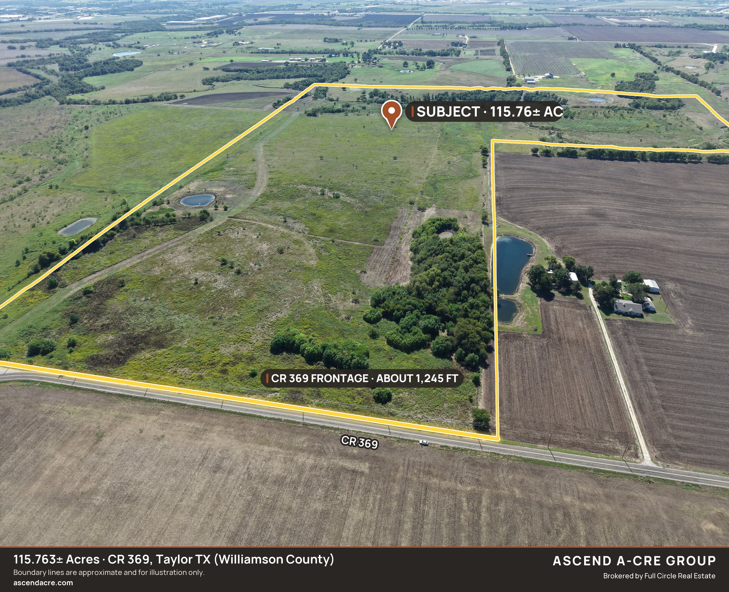
A 115.763-acre tract on County Road 369, north-west of Taylor in eastern Williamson County, offered at $9,492,566 ($82,000 per acre) as a whole-tract sale. The land sits entirely inside the City of Taylor's one-mile extraterritorial jurisdiction (outside city limits), with frontage of about 1,245 ft on CR 369, its only road frontage. The nearest edge of Samsung's Taylor campus land is about 2.35 miles to the south-south-east. On October 8, 2026, the Taylor City Council approved, 5-0, a development agreement for the 664-acre Taylor Technology Campus data-center site on FM 112, about 6.2 miles east, and in 2026 an affiliate of a publicly traded homebuilder acquired about 343 acres directly north across CR 369. Water is in Jonah Water Special Utility District's certificated service area; electric is Oncor; there is no certificated sewer provider today. About two-thirds of the land lies outside the mapped floodplain; about one-third (about 38.5 acres) along Mustang Creek is mapped FEMA Zone A. A recorded 50-foot pipeline easement (about 3.55 acres) crosses the tract. No deed restrictions were found in the vesting deeds. The land is agriculturally valued today. Title and boundary information are available to qualified parties.
Position: North-west of Taylor on County Road 369, inside the City of Taylor ETJ, about 2.35 miles north-north-west of Samsung's Taylor campus land and about 6.2 miles west of the approved Taylor Technology Campus site.
$9,492,566 ($82,000 per acre). Whole-tract sale. About 34% of this tract (about 38.5 acres) is in FEMA flood Zone A, and a recorded 50-foot pipeline easement crosses the property. Buyer to verify all information, including the title commitment and survey.
Highlights
- 115.763± acres, one tract, frontage of about 1,245 ft on CR 369; CR 369 is the only road frontage.
- $9,492,566 ($82,000 per acre); whole-tract sale.
- 100% inside the City of Taylor one-mile extraterritorial jurisdiction, 0 acres in any city limits; Taylor is the platting authority.
- About 2.35 miles (edge to edge) north-north-west of Samsung Austin Semiconductor's Taylor campus parcels.
- Taylor Technology Campus data-center agreement approved 5-0 on 10/8/2026, about 6.2 miles east.
- Water: inside Jonah Water SUD's certificated service area (100% of the tract). Sewer: no certificated provider today; on-site septic or a developer-built path.
- Electric: Oncor service territory.
- Floodplain (disclosed): about 66% outside the mapped floodplain; about 34% (about 38.5 ac) mapped FEMA Zone A along Mustang Creek, no base flood elevation published.
- Pipeline easement (disclosed): a recorded 50-ft pipeline easement (about 3.55 ac) crosses the east side; older electric line easements of record.
- No deed restrictions found in the vesting deeds; title commitment governs.
- Taylor ISD; Lower Brushy Creek Water Control & Improvement District.
- Agricultural valuation in place; a change of use triggers rollback taxes (buyer to confirm with WCAD).
- Context: Taylor Technology Campus approved (10/8/2026). Taylor City Council voted 5-0 to approve a development agreement for the 664-acre data-center campus (formerly Project Mustang) on FM 112, about 6.2 miles east of the tract. (Status: City's draft minutes; final when council approves the 10/8 minutes.)
- Context: Homebuilder next door (2026). An affiliate of a publicly traded homebuilder acquired about 343 acres directly north across CR 369 (Williamson County deed records).
- Context: City impact fees under review. The City of Taylor is updating its water and wastewater impact fees in 2026; a buyer should verify the fee in force at connection.
- On the MLS: Unlock MLS# 9298920
Rahul Kasoju · Ascend A-CRE Group · Brokered by Full Circle Real Estate (Samyama Realty LLC d/b/a Full Circle RE) · TX Sales Agent Lic. #831921 · [email protected] · (737) 257-4737. Rahul Kasoju holds no ownership interest in the property. Texas is a non-disclosure state; no sale prices are represented. Information About Brokerage Services and Consumer Protection Notice available on request. All information deemed reliable but not guaranteed. Ascend A-CRE Group is a TREC-registered team name.
Verified by Ascend A-CRE Group: what we have already proven from primary records
None
- Jurisdiction: Full-parcel GIS overlay: 100% City of Taylor ETJ, 0 ac in city limits
- Flood: FEMA panel 48491C0530F overlay: about 34% Zone A, about 66% outside the mapped floodplain
- Pipeline: Recorded 50-ft pipeline easement, about 3.55 ac (county clerk instruments)
- Water: Jonah Water SUD CCN 10970 covers 100% of the tract
- Electric: Oncor service territory, 100%
- Title read: Vesting deed and recorded easements read at the Williamson County Clerk; no deed restrictions found
- Access: Legal access by the deed's CR 369 right-of-way call
Drone video
Drone flyover, October 2026, 2.5x speed, ends on the boundary outline.
Aerials
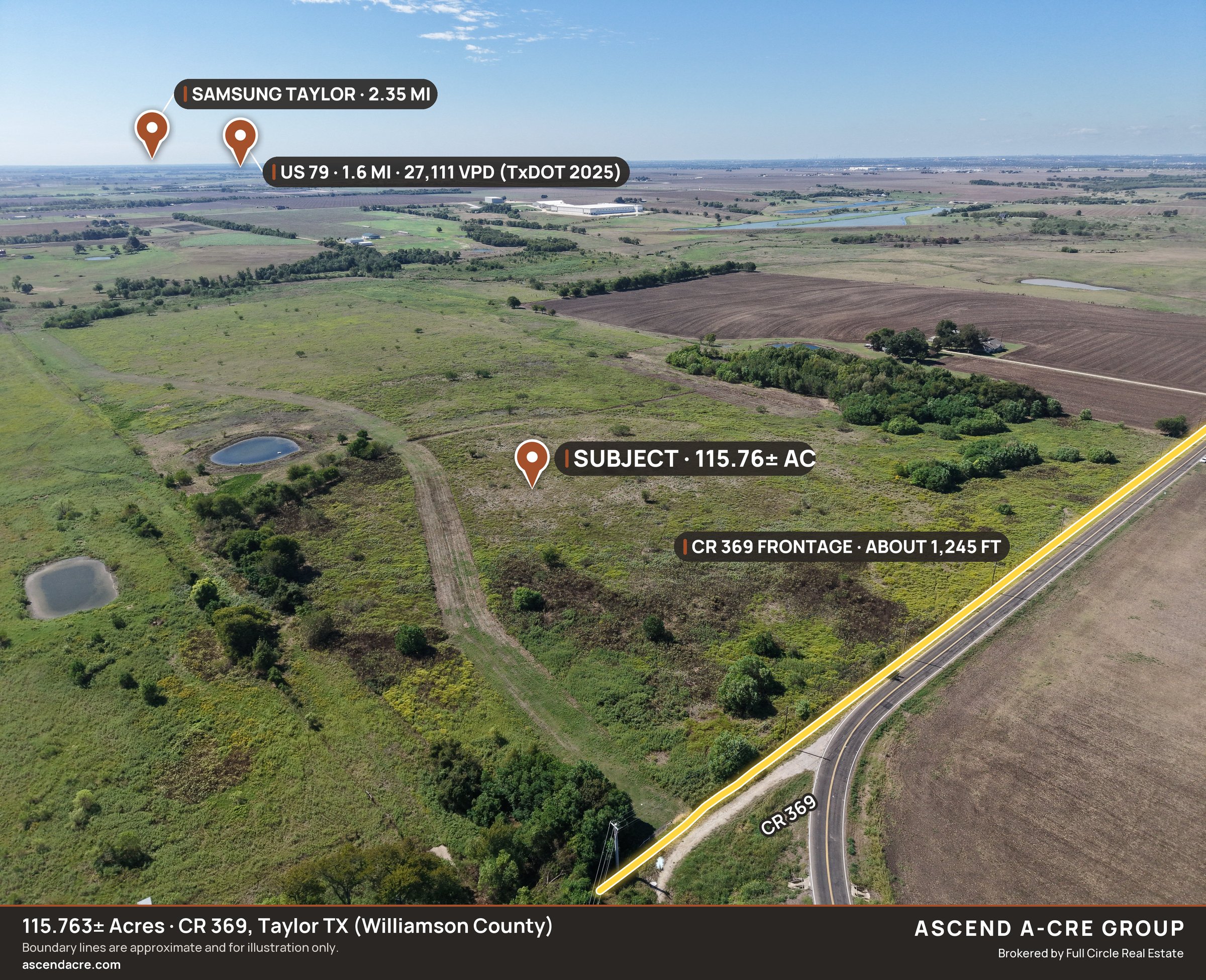
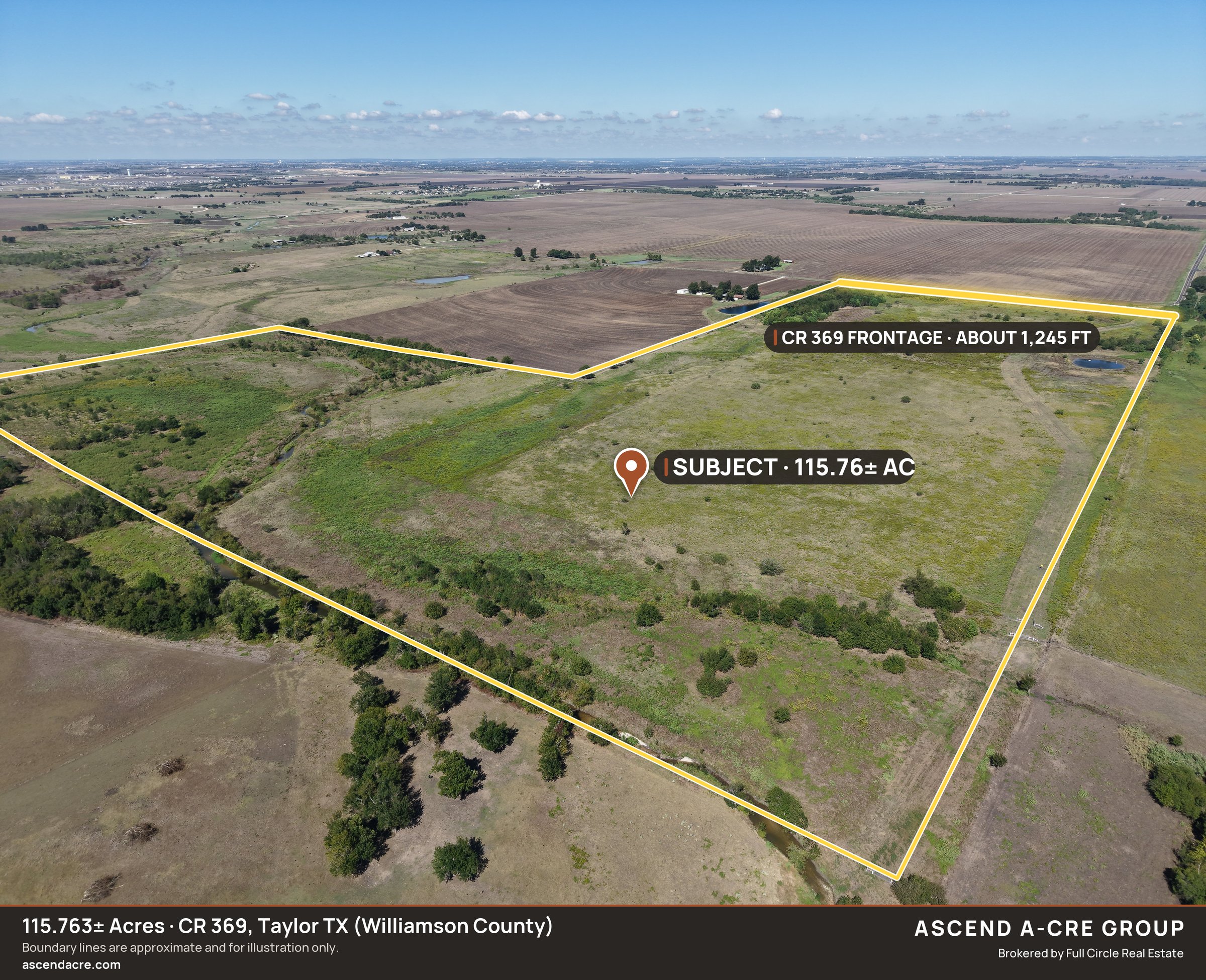
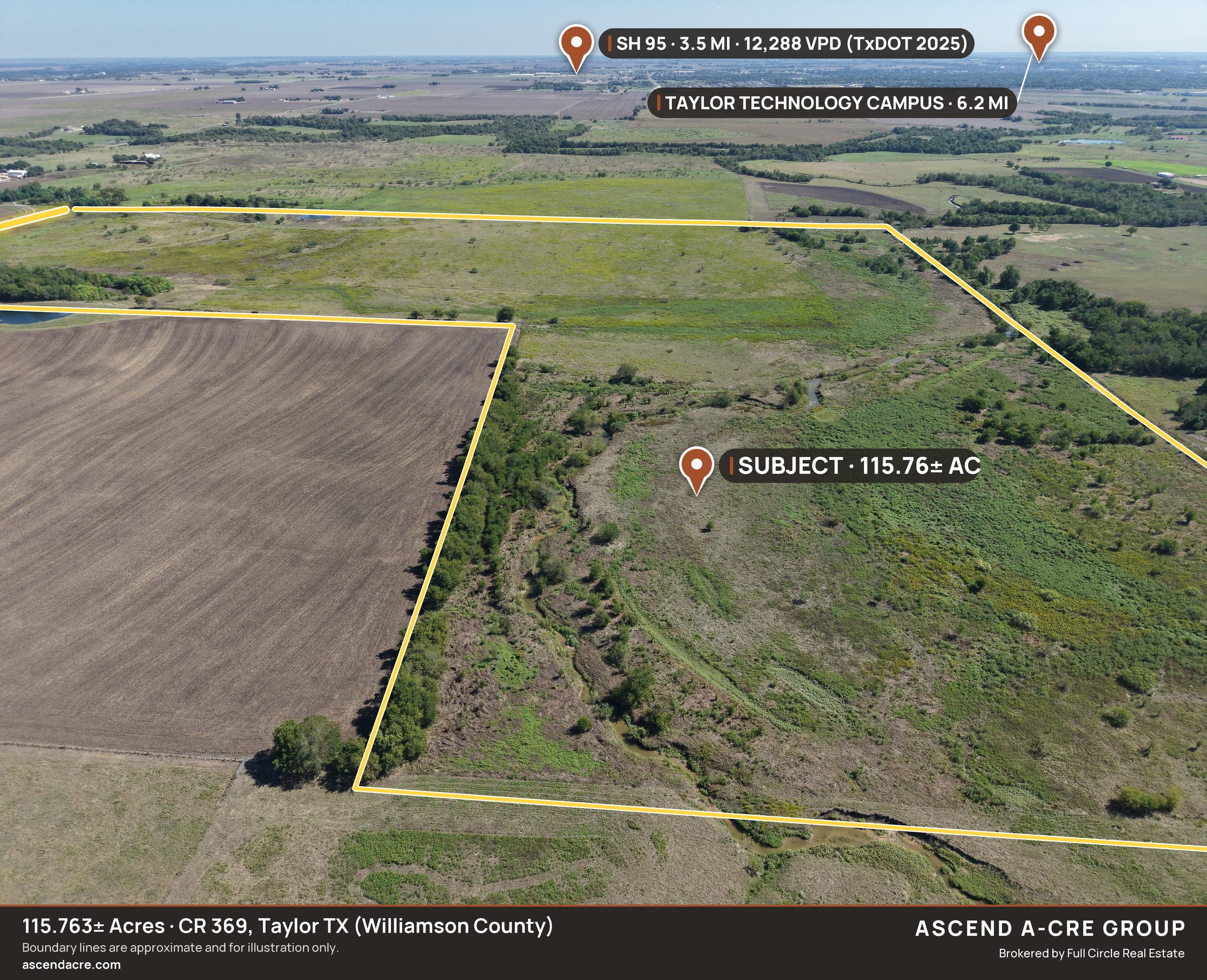
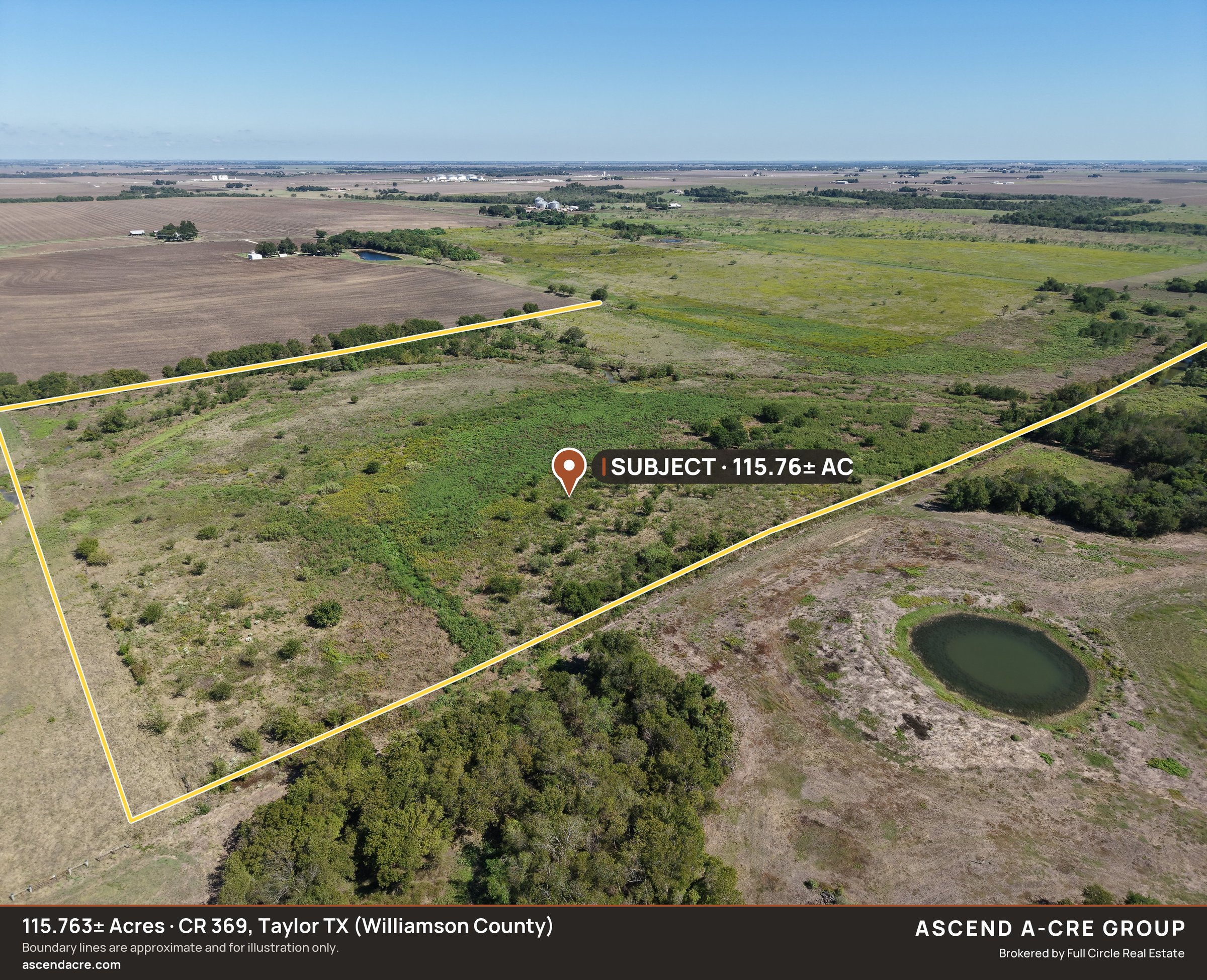
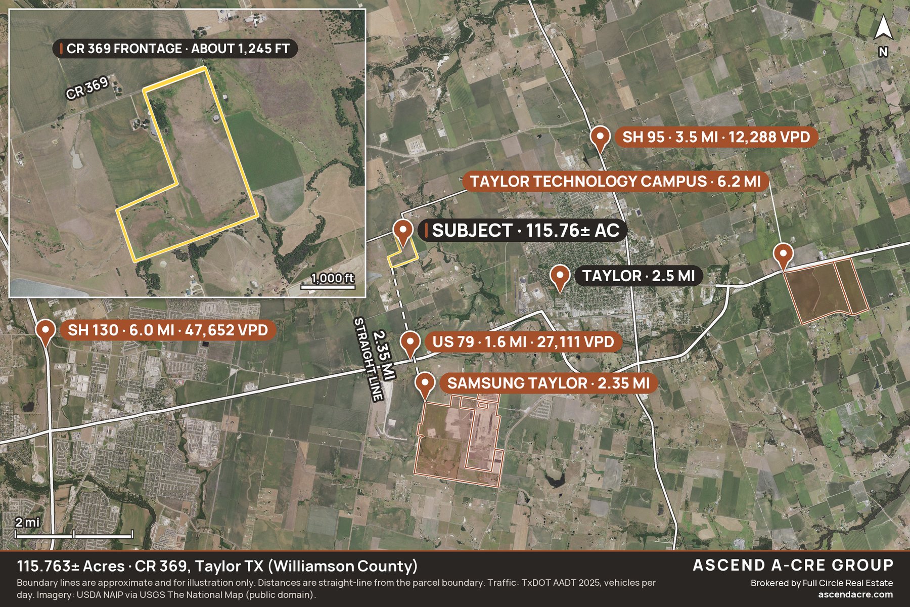
Boundary approximate, from Williamson County GIS parcel data; the recorded survey (115.763 acres) controls.
Boundary lines are approximate and for illustration only.
Request the title and boundary packet
Email [email protected] or call (737) 257-4737.
Or email [email protected] · (737) 257-4737
The market around it
Corridor traffic, demographics, and delivery timelines — source-cited and refreshed on our Williamson County market page.
All information from sources deemed reliable; buyers should independently verify. Texas is a non-disclosure state; any price shown is the seller's asking price, not a closed sale price. This page is advertising by ASCEND A-CRE GROUP, brokered by Full Circle Real Estate — see the IABS and Texas Real Estate Commission Consumer Protection Notice.